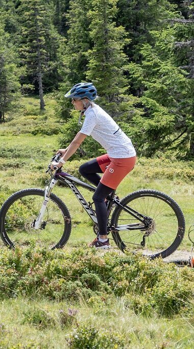
Safe mountain bike and cycling holidays in Piesendorf Niedernsill
Uniform signposts of the mountain bike trails
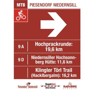
Uniform signposts of the mountain bike trails
Approved mountain bike routes and trails are uniformly signposted with the "Mountain Bike Guidance System SalzburgerLand". A rough distinction is made between red routes and yellow trails (ATTENTION! This does not refer to the yellow hiking signs!!!). In addition to direction, distance and other additional information, uniform pictograms indicate whether the route is uphill, downhill or a bike park route.
Notice!
If you follow the RED mountain bike signs and the GREEN Tauern Cycle Path signs, you are always on the RIGHT WAY! Your tour will be on approved routes.
Levels of difficulty
The classification of the conditional skills, stamina and endurance is done in the areas BLUE "easy", RED "medium" and BLACK "difficult".

BLUE routes - easy
A family-friendly cycle route, suitable for normal bikes, with a good road surface. Suitable for beginners and intermediate mountain bikers, as the routes are short and not too steep. There are no particular dangers. Dangerous spots are indicated by special signs (e.g. signposts). The routes are up to 30 km long, have less than 600 m of difference in altitude and a maximum gradient of 10 %.

RED routes - medium
Requires athletc riding ability and particularly defensive riding. Mountain biking equipment is recommended. The routes are up to 60 km long, with up to 1,500 m of difference in altitude and a maximum gradient of 17 %, and include winding and uneven stretches, as well as hazards such as road surfaces (sometimes coarse gravel), drainage systems and obstacles (barriers, pasture gates, ...).

BLACK routes - difficult
Difficult, demanding, long and/or steep mountain bike route that exceeds the maximum gradient of 17 % for the red route and has even more difficult route characteristics. Numerous moments of danger are to be expected. Mountain biking equipment is compulsory and an anticipatory riding style adapted to the situation is required! The steep terrain along the route is not secured and there are no special safety devices. The routes are over 60 km long, with a difference in altitude of over 1,500 m and a gradient of 17 %.
Rules of conduct for coexistence
Some of our many routes are suitable for both hikers and mountain bikers.
Fairness and mutual respect form the basis for a common together and the protection of the various interests in the natural area!
- Mountain biking is permitted at your own risk from 1st May to 15th November between 2 hours after sunrise and 1 hour before sunset on marked and approved routes.
- Biking is only permitted on marked routes!
- Mountain bikers must respect the priority of motor vehicles and hikers. Mountain bikers should take special care, as they may be exposed to hazards during forestry work or hunting.
- Mountain bikers must adapt their speed to the danger or dismount and push the mountain bike in the area of unclear or dangerous points (sharp bends, bridges, willow gates, barbed wire fences).
- Grazing is to be expected on approved routes.
- Driving, stopping and parked motor vehicles, as well as wood stored at the side of the road, must be expected and attention must be paid to oncoming traffic.
- Taking into account these special conditions, the mountain bike must be ridden such a way that, if necessary, it is possible to dismount and swerve when approached by a motor vehicle.
- Mountain biking is only permitted on properly equipped mountain bikes (as defined by the StVO) that are suitable for the routes. Children under the age of 12 must wear appropriate protective equipment in accordance with the StVO's requirement to wear a cycle helmet.
Further rules
- CLOSE all gates and barriers!
- PROTECT and RESPECT the flora and fauna!
- Don't leave any WASTE in nature!
- AVOID noise and unnecessary skid marks!
LANDOWNERS ARE NOT RESPONSIBLE FOR ACCIDENTS!
Rules with grazing animals on alpine pastures
Information on the safe handling of grazing livestock on the alpine pastures and meadows can be found under safe alpine pastures.
