
Important tips for a successful tour
If you return back to the valley safely under your own steam, then you've done everything right. Hiking Maps and Hiking Guides as well as our Tour App "Piesendorf Niedernsill experience" will help you to climb the mountains of Piesendorf Niedernsill on marked trails with precisely defined levels of difficulty.
When planning your tour, you should consider your own physical condition and that of your companions, as well at the weather conditions. Equipment includes warm clothing, a drink and a snack, as well as a first aid kit with an emergency number. These simple rules will guarantee you an unforgettable mountain experience.
Easy orientation
The uniform sighnposting (yellow) and marking (red-white-red or red-white) in the Salzburg mountains makes it easier for nature lovers to find their way around. The statewide classification of hiking trails into different levels of difficulty also makes it easier to choose the most suitable route for you.
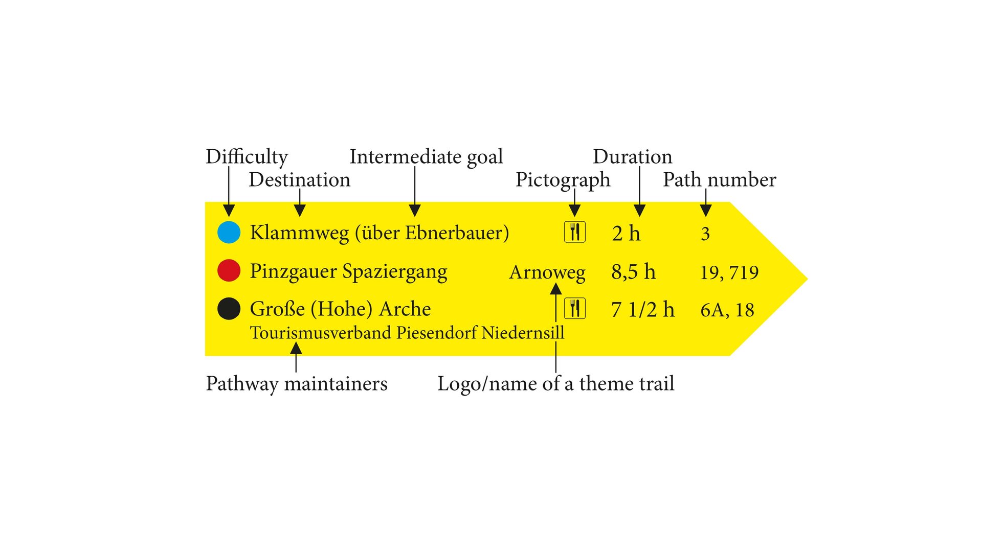
Levels of difficulty of hiking and mountain trails
1st Dimension - BLUE hiking trails | valley trails

Hiking trails are easy, non-exposed, marked paths. They are wide, without danger of falling, with a low gradient and relatively safe to walk on, even in bad weather. They can be walked without special mountaineering knowledge, provided you wear suitable footwear and clothing for the weather.
-
Suitable for? Beginners, leisurely walkers
2nd Dimension - RED hiking trails
 hiking trails | © TVB Piesendorf Niedernsill")
Medium difficulty mountain trails are mainly narrow, often steep, sometimes exposed and require basic mountaineering skills. There may be short secured passages where hands are needed.
-
Suitable for? Sure-footed and enduring mountain hikers with appropriate equipment and alpine experience.
3rd Dimension - BLACK mountain hiking trails
 hiking trails | © TVB Piesendorf Niedernsill")
Difficult mountain trails are narrow, partly or wholly very steep, often exposed and van be dangerous in bad weather. Expect longer secured climbing passages or secured sections.
-
Suitable for? Mountaineers who are free from giddiness, sure-footed, in good physical condition and experienced in alpine climbing, with appropriate equipment.
Calculation of the walking time
Rule for calculating walking time:
- 300 metres in the ascent
- 500 metres in the descent
- 4 kilometres horizontal distance
The actual walking time for a route can be calculated by halving the smaller of the horizontal and vertical distance times and adding it to the larger value.
Example:
Altitude difference 900 m: 900 m / 300 m = 3 hours
Horizontal distance 8 km: 8 km / 4 Km = 2 hours
Approach: 2 hours x 0.5 = 1 + 3 hours = 4 hours
Result: The walking time is 4 hours!
